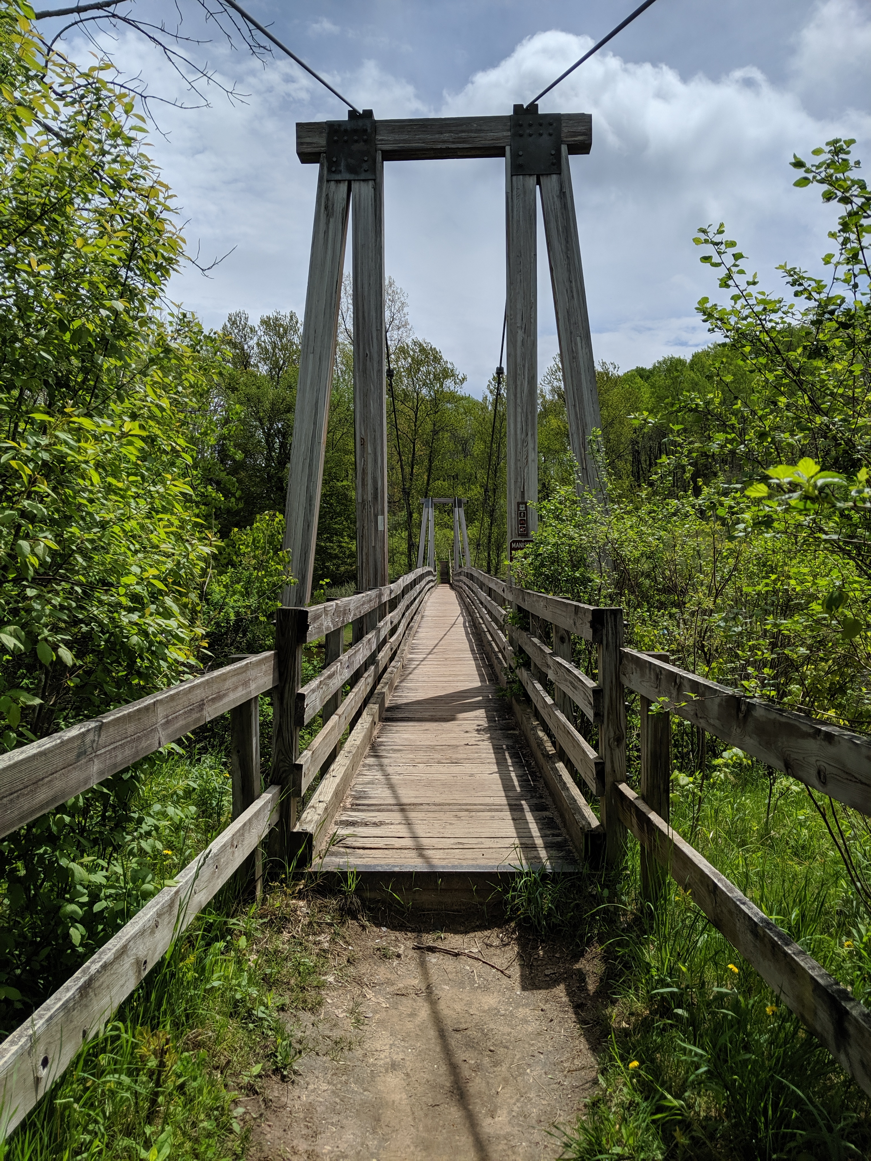
The Manistee River Trail loop is one of the most popular backpacking and hiking destinations in lower Michigan. It is nestled in the Manistee National Forest between the small towns of Brethren and Mesick. The loop consists of the North Country Trail (NCT) on the west side of the Manistee River, two bridges spanning the river (one at the north end, one at the south end), and the Manistee River Trail (MRT) on the east side of the river. My boyfriend John and I decided to backpack this loop over Memorial Day weekend this year and began to do our research on the trail a few weeks in advance. We quickly discovered that there was alot of misleading information out there and different websites contradicted each other. There was one website that was very helpful in preparing us for this trip, however we still showed at the trailhead with a lot of unanswered questions. While some would argue that that just makes for a more authentic adventure experience, I know that there are probably others who would prefer to be more prepared. In light of all of this, I decided to share our experiences on the MRT loop and what we learned along the way.
The Plan:
John and I planned on hiking the trail over the course of 3.5 days. We drove up Friday after work and planned on getting a few miles in before dark. Since it was Memorial Day weekend, we planned on getting most of the hiking done Saturday and Sunday, leaving Monday to wrap up the trip and drive back home. We started on the NCT side since we read that it was more vigorous and very hilly. We then planned on taking it slower on the MRT side due to more river access and to enjoy the views. We also weren’t even sure how fast/far we were going to be able to walk each day since I was not in hiking shape and my backpack was heavier than planned. Another huge uncertainty in our planning was the fact that every website we looked at showed the loop being different lengths. The lengths ranged from 18.5 miles to 29 miles, so we really didn’t know how far we would have to go each day to complete the loop. It was also unclear which trailheads had free parking and which ones had a fee.
The Reality:
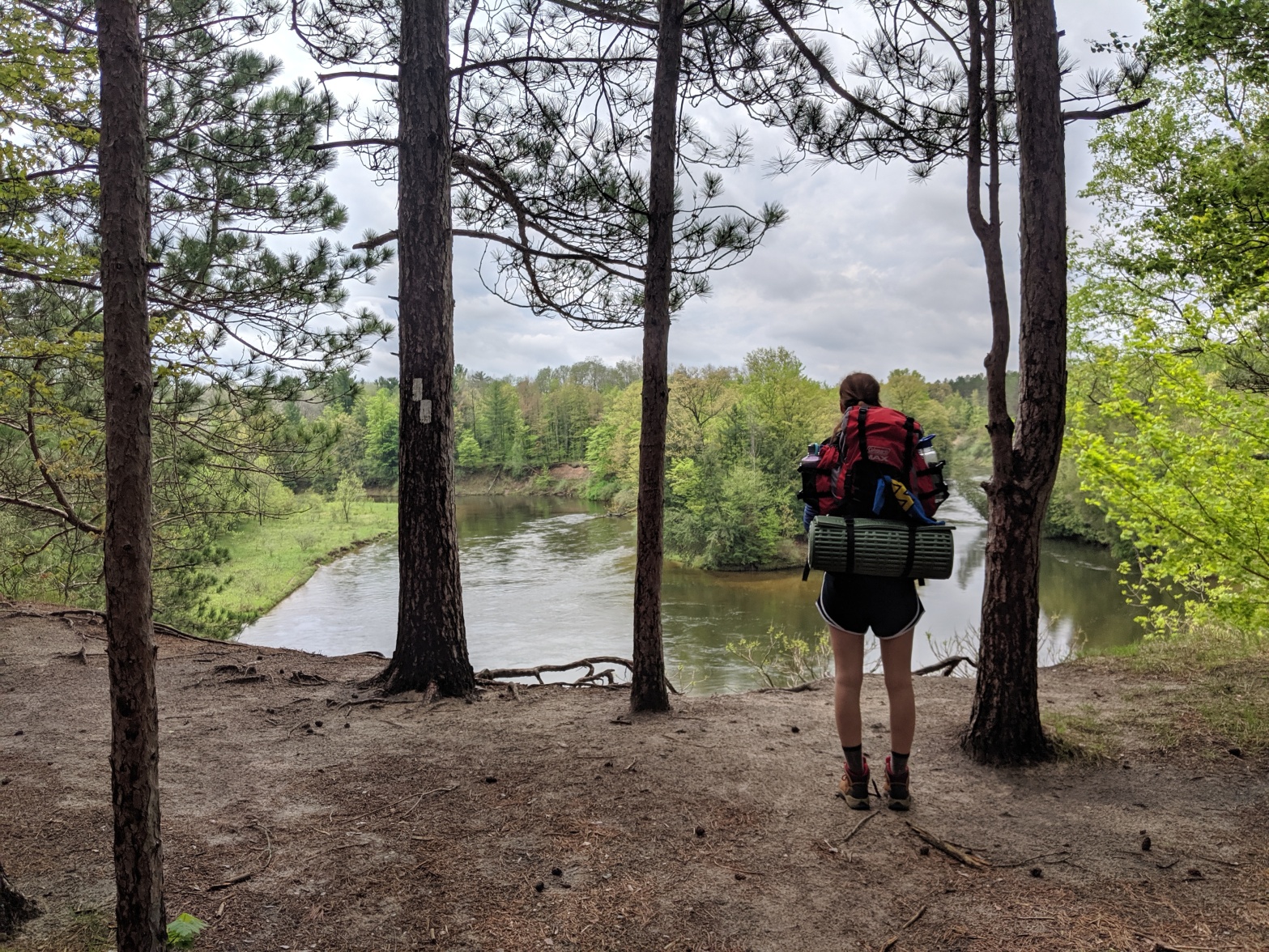
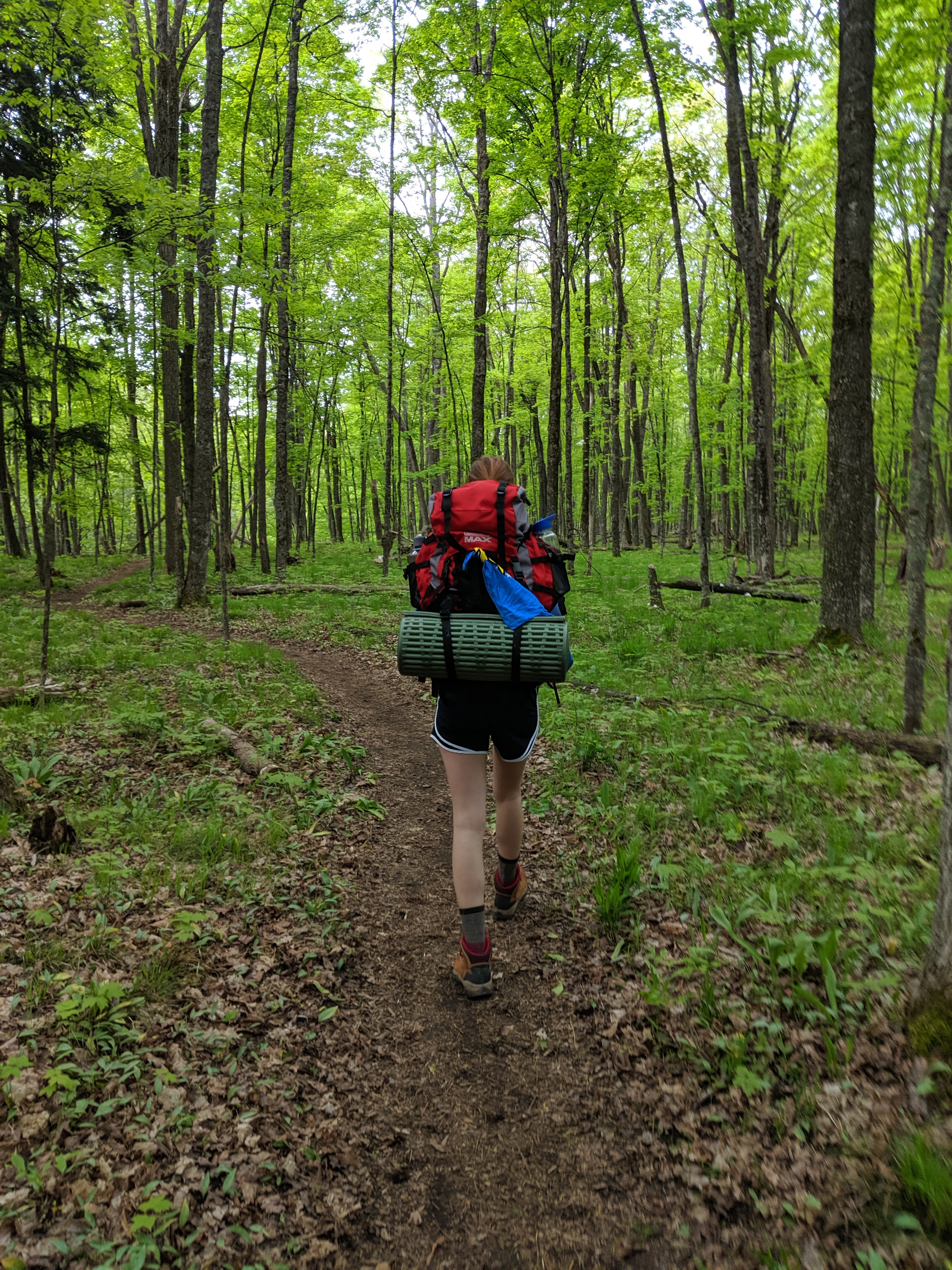
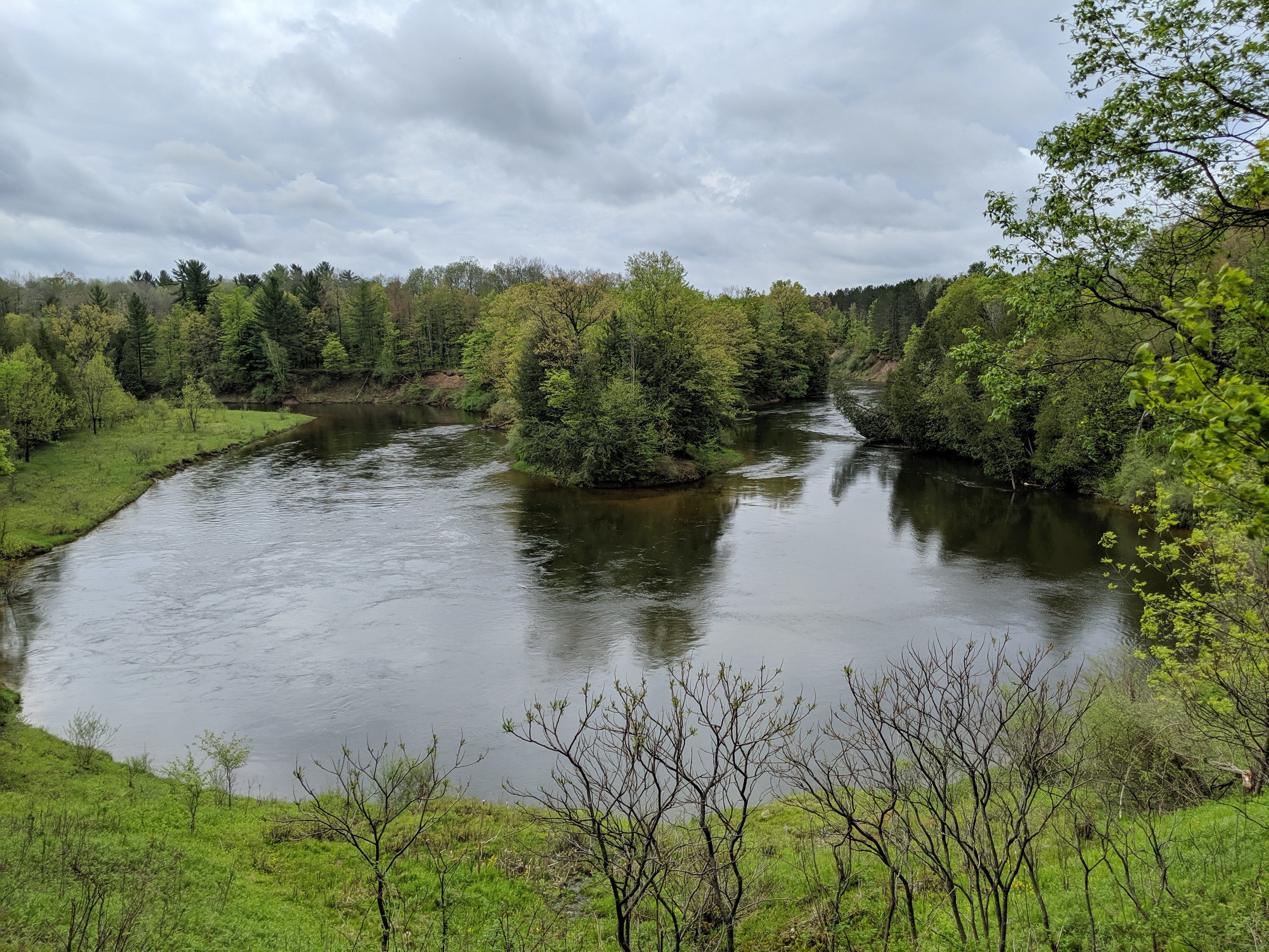
Long story short, our 3.5 day trip turned into a 2-2.5 day trip. On Friday we got 3 miles in before setting up camp for the night. It was a lovely campsite on a bluff with a pretty view of the surrounding forests. The next day, our goal was to get to Eddington Creek. Due to inconsistencies with the maps we weren’t quite sure how far we had to go. The NCT side of the trail was very beautiful with lots of challenging hills which made the hike very fun. We ended up getting to Eddington Creek earlier than anticipated and decided to keep walking until we were tired. We ended up putting in about 12 miles and found a campsite on the MRT side of the loop. The MRT side of the loop was much flatter and had great views overlooking the river. Based on our estimates we realized we were probably only 5-6 miles away from the trailhead we parked at, and would finish the trail a day early. Sunday morning we packed up for the last time and were back to our car around 11am.
Overall, It was a really fun trip and my first time backpacking a loop. The views of the Manistee River were really beautiful and the forests of the NCT trail were just as enchanting. However, due to lack of information there was a lot of confusion about which trailheads had free parking and how long the loop actually was, among other things. So I have compiled a short list of tips for anyone who is looking to hike the MRT loop.
1. There is little water access on the NCT
Several websites mentioned that the NCT side of the trail had little water access and that the trail is often over a mile from the river. My boyfriend and I decided to be extra prepared and filled up two water bottles each plus two filter bags of water. Honestly, this was overkill as we reached Eddington Creek early Saturday afternoon and therefore were only away from water for about 15 hours. I did want to mention this though because we came across the word ‘water’ written in the dirt on the trail with an arrow pointing presumably to a water source, suggesting someone was not quite as prepared as we were. So just keep this in mind when you are planning your trip.
2. There are four main trailheads
The main trailheads are Marilla Trailhead, Seaton Creek Campground, Upper River Trailhead and the Red Bridge Trailhead. There are also several parking areas along the river, but they may be restricted for day use only. John and I decided to park at the Red Bridge Trailhead since it was supposed to be free. The Red Bridge trailhead had a boat launch, outhouse, and water spigot. There were some campsites right along the parking lot as well. However, there were signs posted that said backpackers should leave cars at the Upper Rver Trailhead instead to leave room for people using the boat launch. We decided to move to the Upper River Trailhead, which is about a mile up the road. The Upper River Trailhead is just a small dirt parking area with no amenities. We ended up having to drive back to Red Bridge to fill our water bottles and then go back to Upper River to park. Both trailheads were free. I believe if you park at Seaton Creek campground you will have to pay to park, but I am not sure about the Marilla Trailhead.
3. The maps lie
Okaaay not exactly, but they definitely weren’t as accurate as they should be considering this is one of the most popular backpacking destinations in Michigan. At each major trailhead (and occasionally along the trail) a map was usually posted. And while all the maps were identical, the scale on the map was different on most of the maps. So we didn’t know if one inch equaled ½ a mile as it was shown on one map or if it was 2 miles as shown on another identical map. This made planning out how far we needed to go to get to a campsite pretty difficult. Regardless of which map scale is accurate, the entire loop was approximately 21 miles according to John’s GPS, starting from Upper River Trailhead. The distance may vary if you start from Marilla or Seaton Creek since those trailheads are further from the main trail. I am assuming that is why the USDA Forest Service website states the loop is 23 miles. There is also an All Trails post saying the loop is 29.6 miles but honestly I have no idea how they managed to add an extra 6 miles in there.
4. There are some places where the trail is not marked well
John and I ended up following the wrong trail quite a few times. In most cases, it was because we just weren’t paying attention and absentmindedly stepped over logs placed to block off the wrong trail. However, in other cases there were well traveled trails going in the wrong direction that were very misleading. All the “wrong” trails usually just went to campsites or down to the river. The entire loop is very easy to follow with a clear trail on the ground, there are just so many other trails branching out that it is easy to accidentally follow the wrong one. My advice is to just keep an eye out for the blazes on the trees and if you don’t see one for a while you may be on the wrong trail.
If you keep these things in mind you are sure to have a wonderful time. For me, this trip was the perfect reminder that I live in such a beautiful state and that there is still so much of Michigan that I need to explore.
Until the next adventure,
Shelby

Great write-up!
LikeLiked by 1 person
Thank you!
LikeLike
Very good info Shelby!
LikeLiked by 1 person
Thank you!
LikeLike
Very helpful – thank you! My son and I are hiking the Manistee River Loop in a couple weeks. Quick question… did you take any precautions to guard your food from bears (or rodents) – hanging your food, bear canisters, etc.? I assume you didn’t actually see a bear, as surely that would have made it into your write-up!
LikeLike
We were not too worried about bears since it is a very high trafficked area and so did not use bear canisters. We didn’t even hang our food just kept it outside of the tent and didn’t have any issues. Hope you have a great trip!
LikeLike
Got it. Thank you for your prompt response!
LikeLiked by 1 person
Thanks for the great read! Should like a tough time with the maps… keep up the amazing content ✌️
LikeLiked by 1 person